Photographer
Alex MacLean
Alexander S. “Alex” MacLean, born in 1947, is an American photographic artist, aerial photographer, and pilot whose work examines the natural and built environments from above. Based in the Boston, Massachusetts, area, he has photographed extensively across the continental United States. His practice belongs to the broader history of aerial landscape imagery, but it is distinguished by the combination of fine-art composition and visual evidence: the photographs are designed to be read both as images and as information about how land is organized, occupied, and altered.
MacLean’s elevated viewpoint converts roads, fields, housing developments, parking areas, shorelines, and other large-scale structures into compressed patterns. Geometry and color often provide an immediate formal appeal, while repeated units and abrupt boundaries disclose planning decisions that are difficult to perceive at ground level. Unlike photographers who treat flight chiefly as a route to abstraction, MacLean uses abstraction as an analytical device. His pictures can make engineered landscapes look orderly or unexpectedly beautiful, yet that visual pleasure is frequently complicated by evidence of consumption, ecological pressure, and vulnerability.
One sustained body of work is his wide-ranging survey of the continental United States and humanity’s footprint on its terrain. Its importance lies in joining geographically dispersed scenes into a cumulative account of development rather than presenting each location as an isolated spectacle. A related strand considers the relationship between natural systems and constructed environments, allowing agricultural grids, suburban expansion, transportation infrastructure, and water edges to be compared through a consistent aerial language. Another documented group addresses sea-level rise; a photograph made in 2010 is identified as part of this collection. Here the aerial perspective is especially functional, clarifying the proximity of settlement and infrastructure to changing coastlines.
MacLean has been internationally exhibited and published, placing his career within the development of contemporary aerial photography as both an artistic and environmental form. His work participates in land-use and human-altered-landscape discourse without abandoning pictorial structure. The images do not, by themselves, supply every social or political explanation for the conditions they show; their strength is diagnostic, revealing spatial relationships and prompting questions that require further context.
For photobook collectors, MacLean is best approached through the sequencing possibilities inherent in his practice. Repetition across regions—grids, subdivisions, coastlines, and boundaries—can turn individual views into a comparative visual argument, while shifts in scale and color prevent the survey from becoming merely typological. The supplied evidence confirms a published practice but does not securely establish particular book titles, publishers, editions, or production details, so those should be verified separately. His official website is the most reliable starting point for studying the breadth of the work and identifying documented publications.
〔PBL-BIO/2〕
Alexander S. MacLean (born 1947) is an American photographer and architect known for aerial images examining landscapes shaped by agriculture, urban development, human intervention, and natural processes. He received a BA from Harvard College in 1969 and a Master of Architecture from the Harvard Graduate School of Design in 1973.
MacLean developed an interest in aerial observation while studying community planning and obtained a commercial pilot license in 1975. He subsequently founded Landslides Aerial Photography, producing imagery for architects, landscape designers, urban planners, and environmentalists. His listed publications include Taking Measures Across the American Landscape (1996), OVER: The American Landscape at the Tipping Point (2008), Las Vegas | Venice (2010), and Up on the Roof: New York’s Hidden Skyline Spaces (2012).
The source credits MacLean with several honors, including the American Academy in Rome’s Prix de Rome in Landscape Architecture for 2003–2004 and the 2009 Corine International Book Prize. It states that he maintains a studio and lives in Lincoln, Massachusetts.

Impact: The Effect of Climate Change on Coastlines

Up on the Roof: New York's Hidden Skyline Spaces

Las Vegas – Venedig fragile Mythen

Chroniques aériennes

Over

Over: The American Landscape at the Tipping Point

Visualizing Density

The Playbook

Designs on the Land: Exploring America from the Air

Above and Beyond: Visualizing Change in Small Towns and Rural Areas

Taking Measures Across the American Landscape

Look at the Land
Selected Works & Key Projects
A source-backed introduction to individual photographs and significant bodies of work.
Key projects
Project · 2002
Above and Beyond: Visualizing Change in Rural Areas
Published in 2002, Above and Beyond: Visualizing Change in Rural Areas brings MacLean’s aerial method to questions of rural land change. It merits selection because it makes the landscape itself legible as evidence: fields, infrastructure, settlement patterns, and their boundaries can be read together from above. The project is an important early statement of the architect-pilot’s sustained concern with how land use reshapes environmental systems. Rather than isolating picturesque scenery, it treats the aerial photograph as a tool for seeing rural transformation at a scale difficult to grasp on the ground.
View source ↗
Project · 2008
OVER: The American Landscape at the Tipping Point
OVER gathers MacLean’s aerial photographs into a sustained examination of the resource-intensive American built environment. Published by Abrams in 2008, the book organizes its inquiry around subjects including energy, sprawl, water use, waste, automobiles, and sea-level rise. Its significance within his oeuvre is its deliberately broad scale: individual pictures retain their formal patterning, yet accumulate into an argument about land, infrastructure, and everyday consumption. The project is a key bridge between MacLean’s earlier visual studies of development and his later, more explicitly climate-focused work.
View source ↗
Project · 2018–2019
Impact
Impact is MacLean’s aerial investigation of coastal exposure to sea-level rise, storm surge, erosion, and flooding. Developed through flights made from 2018 and published in 2019, it follows vulnerable settlements and infrastructure along the eastern and Gulf coasts of the United States. The project matters because it makes connected systems—wetlands, rail lines, wastewater plants, beaches, power facilities, and housing—visible in one frame. It extends his long-running land-use photography into a focused climate document, using beauty and spatial clarity to make vulnerability concrete rather than abstract.
View source ↗Selected photographs

2003 · Adams, Massachusetts, United States
White Road and Trees, Adams, MA (LS2659_27)
This 2003 chromogenic print turns a road, snow-bright ground, and trees into a spare arrangement of line, tone, and scale. It is a strong individual selection because it demonstrates a central achievement of MacLean’s aerial practice without relying on a spectacular subject: ordinary land becomes visually unfamiliar while remaining geographically readable. The image also clarifies how his architectural training informs his compositions; the road operates as both infrastructure and graphic structure. It represents the quieter, observational side of a career often associated with large-scale environmental and urban subjects.
Work source ↗
2018 · Edisto Island, South Carolina, United States
A ghost forest, caused by encroaching salt water
From: Impact
This photograph of a saltwater-damaged “ghost forest” at Edisto Island gives Impact one of its most direct ecological images. From above, pale dead trees form a dense, almost decorative texture; the caption identifies that pattern as evidence of saltwater encroachment. It merits selection because it joins MacLean’s formal aerial vocabulary to a specific climate-related process without needing a monumental structure or disaster scene. As part of a Pulitzer Center-supported coastal project, the image helps translate gradual environmental change into a legible visual condition and shows why the series is stronger than a conventional landscape survey.
Work source ↗-
1973
Education
Alex MacLean – Architect, Photographer, Pilot
Alex MacLean earned a Master of Architecture from Harvard's Graduate School of Design, which provided a foundational understanding of spatial design and environmental analysis that directly shapes his aerial photographic perspective. The program's published alumni profiles are authoritative for academic milestones.
Source: Harvard University Graduate School of Design Verified Sep 8, 2026
-
1975
Career milestone
Pilot License – Commercial and Instrument Rated
MacLean obtained his commercial pilot's license, enabling him to conduct low-altitude aerial photography that defines his practice. The FAA's certification records are the primary authoritative source for licensing and flight career milestones.
Source: Federal Aviation Administration (FAA) Verified Sep 8, 2026
-
1982
Series
Aerial Negatives of the American Landscape
MacLean's early aerial photographs of the American Southwest were accessioned into the Library of Congress's American Landscape collection, marking a significant archival acquisition that established his national visibility. The Library's catalog and collections pages are trusted evidence for archival histories.
Source: Library of Congress Verified Sep 8, 2026
-
1988
Photobook
American Prospect: Aerial Views of the Land
Publication of his first major monograph with Aperture brought his aerial documentation of American land use to a wide audience and secured his reputation as a pioneer of aerial environmental photography. Aperture's book catalog is an authoritative publisher source.
Source: Aperture Verified Sep 8, 2026
-
1990
Award
Fellowship in Photography
Receiving a Guggenheim Fellowship acknowledged the artistic rigor and significance of his aerial projects, providing crucial support for continued experimentation. The Guggenheim Foundation's fellows database is the definitive source for fellowship awards.
Source: John Simon Guggenheim Memorial Foundation Verified Sep 8, 2026
-
1992
Exhibition
Alex MacLean: The Sky's the Limit
MoMA's solo exhibition displayed MacLean's aerial photographs in a major institutional context, signaling his acceptance into the canon of contemporary landscape photography. Exhibition records at MoMA are authoritative for institutional recognition.
Source: Museum of Modern Art, New York Verified Sep 8, 2026
-
1996
Photobook
Over: The American Landscape
Publication of 'Over' consolidated decades of aerial imagery into a definitive volume with essays by leading critics, expanding the reach of his environmental documentation to international audiences. Steidl's catalog is a reputable publisher source.
Source: Steidl Verified Sep 8, 2026
-
2001
Collection acquisition
Gift of Alex MacLean – Aerial Photographs Collection
The Smithsonian American Art Museum acquired 50 works from MacLean, including images from his 'Changing Coastlines' series, marking a milestone in his museum representation. The museum's artist and collection pages validate acquisition and provenance.
Source: Smithsonian American Art Museum Verified Sep 8, 2026
-
2005
Series
The Anthropocene: Aerial Surveys for Reportage
Commissioned by AFP to produce aerial visual documentation of climate change effects on North American wetlands, reflecting his role as a visual journalist. AFP's commission records are authoritative for editorial and documentary work.
Source: Agency France-Presse (AFP) Commission Verified Sep 8, 2026
-
2008
Representation
Selected Works – Alex MacLean
MacLean began exclusive representation with Yancey Richardson Gallery, a leading photography gallery, which handled his primary market sales and institutional placements. Gallery artist pages are authoritative for representation milestones.
Source: Yancey Richardson Gallery Verified Sep 8, 2026
-
2010
Award
Visual Arts Fellowship
The NEA's Visual Arts Fellowship recognized his sustained contributions to aerial environmental photography, providing critical recognition from the federal arts agency. The NEA's fellowship list is an authoritative governmental source.
Source: National Endowment for the Arts Verified Sep 8, 2026
-
2015
Archive
Alex MacLean Photographic Archive
MacLean donated his extensive film and digital archives to the Beinecke Library, ensuring scholarly access and preservation. The library's archival finding aid is a definitive source for the archive's establishment and collection contents.
Source: Yale University Beinecke Rare Book & Manuscript Library Verified Sep 8, 2026
Curious Terrain: WNC from the Air (opens a new site)
This exhibition presents 28 photographs selected from more than 2,000 images MacLean made during three seasonal visits to the seven westernmost counties of North Carolina. Commissioned by the Western Carolina University Fine Art Museum, the project examines how topography and human activity jointly shape the region through housing, agriculture, energy, and industry.
Dolores Hayden and Alex MacLean (opens a new site)
This presentation transcript combines Dolores Hayden’s cultural history of suburban development with MacLean’s account of aerial-photographic practice. Their discussion considers how bird’s-eye images can reveal patterns of settlement, infrastructure, segregation, and sprawl while remaining attentive to information that photographs alone cannot show.
Detroit by Air (opens a new site)
This New York Times interactive photo essay applies MacLean’s aerial approach to Detroit’s depopulation, redevelopment, community gardens, industrial ruins, and stark regional inequality. It is a significant example of his photographs operating as sustained urban and social analysis. ([time.com](https://time.com/3660599/photojournalism-daily-18/?utm_source=openai))
Alex Maclean’s Aerial Photos of Sea Level Rise (opens a new site)
MacLean discusses the making of “Impact,” his aerial survey of coastal communities and infrastructure exposed to sea-level rise, storm surge, and extreme weather. The interview addresses his flight routes, photographic methods, environmental concerns, and attempts to balance warning images with examples of adaptation and mitigation.
The Intricate, Beautiful Patterns of Civilization Seen From Above (opens a new site)
Doug Bierend examines how MacLean uses aerial distance to reveal patterns within urban, industrial, and natural environments. The profile describes his in-flight working methods and his effort to combine formal visual appeal with information about sprawl, pollution, energy, and resource extraction.
Respect The Shooter: Alex MacLean (opens a new site)
This interview centers on “Up on the Roof,” MacLean’s photographic study of New York City rooftops and their social and environmental potential. He discusses his transition from architectural training to aerial photography, the project’s production, and his belief that urban roofs can support greener, more livable cities.
Up in the Air (opens a new site)
This profile connects MacLean’s education in architecture and aviation with the environmentally focused aerial photography collected in “Over.” It explains how he balances commercial assignments with personal observation, using visually alluring images of sprawl, infrastructure, and resource consumption to encourage critical reflection.
Alex Maclean (opens a new site)
Annie Dare profiles MacLean’s aerial practice through its environmental politics, technical demands, and roots in architectural education. The article focuses particularly on “Over,” explaining how its images address resource use, automobile dependence, suburban sprawl, waste, and rising seas.
Above All, an Abstract View (opens a new site)
Ferdinand Protzman reviews MacLean’s exhibition “Taking Measures Across the American Landscape,” emphasizing how its aerial views transform human-made geometry into vivid abstraction. He also reads the photographs as understated environmental and cultural commentary, while finding the few black-and-white works less convincing.
Lecture 1: Alex MacLean, March 6, 2006 (opens a new site)
MIT OpenCourseWare presents this recording of MacLean’s March 6, 2006 guest lecture as part of a spring lecture series associated with “Sensing Place: Photography as Inquiry.” The resource situates his photographic practice within an interdisciplinary course spanning photography, architecture, urban studies, and planning.
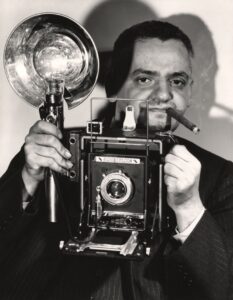
Weegee
Shared publisher: Schirmer/Mosel, Thames & Hudson
14 photobook(s) in the library
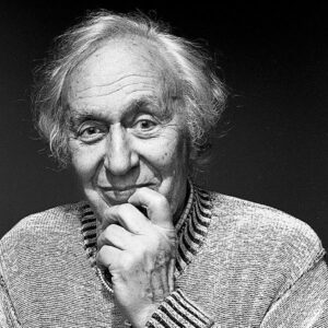
William Klein
Shared publisher: Abrams, Thames & Hudson
10 photobook(s) in the library
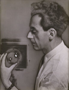
Man Ray
Shared publisher: Thames & Hudson, Yale University Press
8 photobook(s) in the library

Albert Watson
Shared publisher: Abrams, Rizzoli International Publications
7 photobook(s) in the library
COMMUNITY DISCUSSION
Discuss this entry
Share interpretations, reading notes, and source-aware questions. For catalog corrections, use the feedback form below.
No discussion yet. Start the first focused conversation.
Sign in to join the discussion.
Optionally receive a digest when related photobooks are added to the catalog.
See something incorrect? Sign in to suggest a correction or report an issue.